Edge of the Universe
- Jul 3
- 3 min read

Day 14 and we are heading out from Spring Creek, Nevada to a remote region of the Earth about 330 miles away. Yes we actually do have an outback here in the US and it’s located in the State of Oregon! Encompassing 2.5 million acres, the Oregon Outback is a vast region of high desert in South Central and Southeastern Oregon.
The skies above the Outback are among the darkest in the world. According to the Light Pollution Science and Technology Institute research, the site is within the largest contiguous Dark Sky Sanctuary in the lower 48 states of the US!
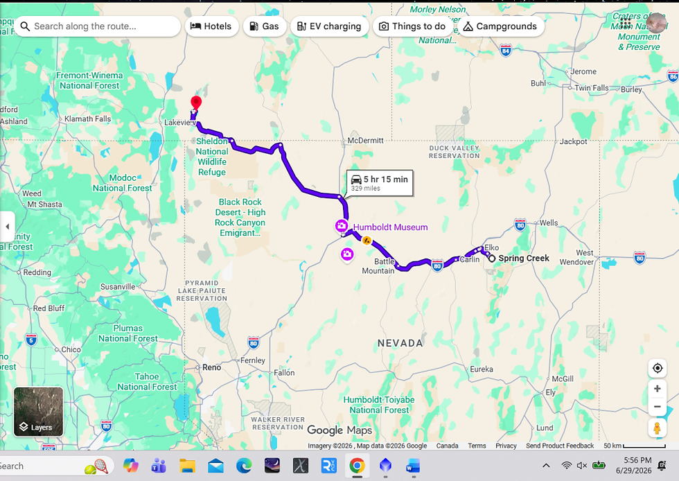
We headed to a region surrounding the town of Plush, Oregon. Originally we had intended to camp at the Hart Mountain wildlife refuge but it was a little bit of a climb with questionable roads for our RV, so we found a spot not far from there which was still part of the refuge but a little further south on Crump Lake.

It turned out to be a great spot! Completely unobstructed horizon view to the southeast. It was basically a pullout on BLM land (Bureau of Land Management which basically means public access).
This odd bird was chirping at me while we were setting up. Apparently it is called a “Killdeer” because the 2 syllable call sounds just like “kill” “deer”. Apparently it lays its eggs on the ground right on the rocks for camouflage and I suspect we were close to them! (I did confirm there were none immediately surrounding the RV!)
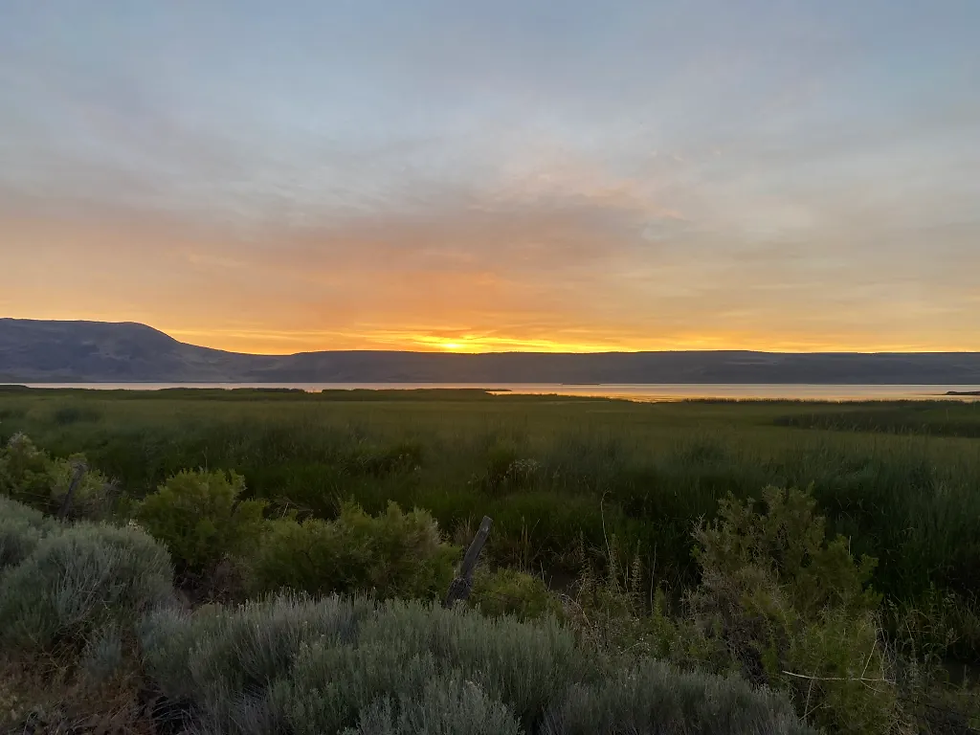

This was the foreground I used in the Milky Way shot. I crossed the road and set up right next to this creek.
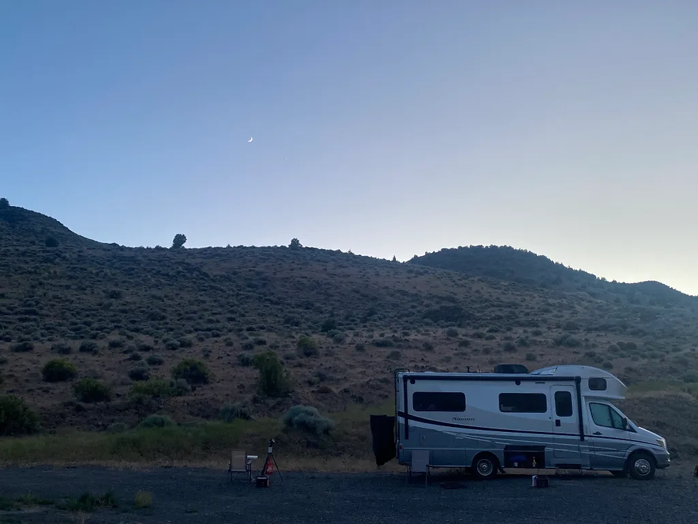
This was the view to the West, opposite the lake. This side was obscured by the small ridge so I wanted to be sure we had an unobstructed horizon view to the Southeast for imaging.

Here was my setup for the 2 nights there. The mount and tripod next to the table and chair was for my small refractor and behind that is the setup used for the nightscape Milky Way shot.
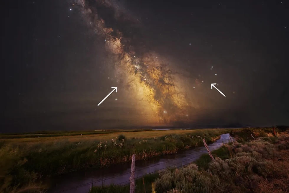
And finally the 2 projects I did while we were there! This one is a standard Milky Way view from the Northern Hemisphere highlighting the galaxy’s core which is in the direction of the constellation Sagittarius- left arrow. The right arrow points to the constellation Scorpio.
This image was a composite of the Milky Way and foreground. For the Milky Way I used a Canon R5 camera with a Sigma 14mm f/1.8 lens I stopped down to 2.0 with ISO of 3200. I used a Vixen Polarie star tracker for the Milky Way. The foreground was a single image I took about 1/2 hour after sunset. Settings there were f/4, ISO 500, 0.8 sec.

Of course I had to take advantage of the darkest sky I have ever seen! This is M22, a globular cluster that sits right in the Milky Way star cloud. Just a single 3 minute uncalibrated exposure with my FSQ 106N, Rainbow Astro mount and QHY 268C camera. I was able to accumulate about 3 hours worth of data in the 2 nights we were there, so we will see if that was enough to reveal the surrounding star cloud and dust.
So far this has to be one of the highlights of the trip! One of the most beautiful and peaceful places I have ever been to..and of course the darkest skies ever!
Thanks for reading...and watching!
DrDave


Comments